|
|
|
| Missing In Action (MIA) | Prisoners Of War (POW) | Unexploded Ordnance (UXO) |
| Chronology | Locations | Aircraft | Ships | Submit Info | How You Can Help | Donate |
|
 Kevin Denlay 1996 |
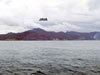
Location Java Island is part of the Greater Sunda Islands (Greater Sundas). Also known as simply Java or spelled Jawa. Borders the Sunda Strait and Java Sea. Off the eastern tip is Bali Island. To the south borders the Indian Ocean and to the north borders the Java Sea. Prewar and during the Pacific War part of the Netherlands East Indies (NEI). Today part of Indonesia and divided into four provinces: East Java Province (Propinsi Jawa Timur), Central Java Province (Propinsi Jawa Tengah), West Java Province (Propinsi Jawa Barat) and Banten Province (Propinsi Banten) plus the Yogyakarta Special Region and Jakarta Special Capital City Region. Wartime History The Battle of the Java Sea between February 27, 1942 until March 1, 1942 American, British, Dutch and Australian (ABDA warships engage the Imperial Japanese Navy during three engagements over three days. On March 9, 1942 at 9:00am Allied commander Lt. General Ter Poorten announces the surrender of of the Royal Netherlands East Indies Army on Java, completing their conquest of Netherlands East Indies (NEI). Jakarta Special Capital City Region Includes Jakarta (Batavia, Djogkarta, Jacarta, Djakarta, Jogkarta) the national capital of Indonesia. Special Region of Yogyakarta Includes Yogyakarta (Jogjakarta, Djogjakarta). East Java Province (Propinsi Jawa Timur) Eastern side of Java. To the north of is Madoera Island and east is Bali Island. Central Java Province (Propinsi Jawa Tengah) Central province of Java spanning from the northern to southern coast of Java. West Java Province (Propinsi Jawa Barat) Western portion of Java spanning from the northern to southern coast of Java. Banten Province (Propinsi Banten) Westernmost province of Java. Contribute
Information Last Updated
|
| Discussion Forum | Daily Updates | Reviews | Museums | Interviews & Oral Histories |
|