|
|
|
| Missing In Action (MIA) | Prisoners Of War (POW) | Unexploded Ordnance (UXO) |
| Chronology | Locations | Aircraft | Ships | Submit Info | How You Can Help | Donate |
|
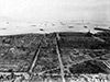  USAAF May 1945 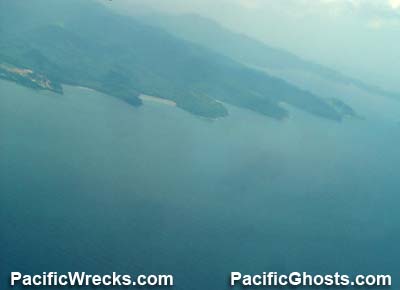 Justin Taylan 2005 |
Location Manila Bay located center western of Luzon in the Philippines. Borders Manila in the National Captial Region (NCR) to the east, Bulacan Province and Pampanga Province to the north, Cavite Province to the south and the Bataan Peninsula in Bataan Province to the west. The eastern area is also known as Manila Harbor. The western edge connects to the South China Sea. At the entrance to Manila Bay is the North Channel and South Channel seporated by Corregidor Island, Caballo Island near the coast of Cavite Province is El Fraile Island and Carabao Island. Today, the four islands are part of Cavite Province and designated as a Military Reservoir Zone and National Park. Wartime History On December 26, 1941 Manila was declared an "Open City" by General MacArthur to make the city demilitarized in hopes of saving the city from being bombed or causing civilian casualties. After the surrender of American and Filipino forces, the Japanese occupied Manila Bay and used the anchorage during their occupation of Luzon until early 1945. Liberated during late February 1945, but the harbor was obstructed by many shipwrecks and debris left by the Japanese to block the harbor. Afterwards, the U.S. Navy (USN) 7th Fleet worked to clear obstacles before the anchorage was deemed safe for use in April 1945. Corregidor Island (Fort Mills, The Rock) Island fortress guarding the entrance to Manila Bay fortified with gun batteries Caballo Island (Fort Hughes) Another fortified island, off limits to visitors today El Fraile Island (Fort Drum) Located at the southern entrance of Manila Bay, developed into a battlefield shaped fortress Carabao Island (Fort Frank) Island with fortress, at the southern entrance to Manila Harbor, nearest to Cavite Hatsuharu Sunk November 14, 1944 into shallow water in Manila Bay Kiso Sunk November 13, 1944 by carrier aircraft into shallow water refloated January 1956 and scrapped Contribute
Information Last Updated
|
Map Feb 23, 1945 Map Fallingrain |
| Discussion Forum | Daily Updates | Reviews | Museums | Interviews & Oral Histories |
|