|
|
|
| Missing In Action (MIA) | Prisoners Of War (POW) | Unexploded Ordnance (UXO) |
| Chronology | Locations | Aircraft | Ships | Submit Info | How You Can Help | Donate |
|
 USN October 11, 1943 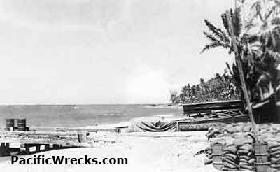 Roy Davenport 1944 |
Location Lat 9° 24' 0S Long 160° 10' 60E Koli Point is located on the north coast of Guadalcanal. Borders Iron Bottom Sound to the north. The Naumbu River mouth empties into the sea at this location. To the east is Togoma Point. To the west are Honiara and Henderson Field. Wartime History During 1943, the U.S. Army 48th Station Hospital was established to the west of Koli Point. During early 1943, Carney Field (Bomber 2) and Koli Field (Bomber 3) were built to the south. On June 14, 1943 a pair of G4M1 Bettys bombed Koli hitting the U.S. Army 161st Infantry Regiment camp area. Carney Field (Bomber 2) Located to the south of Koli Point this airfield was built by the Americans and developed into a major bomber base. An emergency crash strip was located parallel to the airfield. Koli Field (Bomber 3) Located fifteen miles from Henderson Field, closest to Metapona River to the east and Naumbu River to the west. Contribute
Information Last Updated
|
Map Fallingrain |
| Discussion Forum | Daily Updates | Reviews | Museums | Interviews & Oral Histories |
|