|
Location
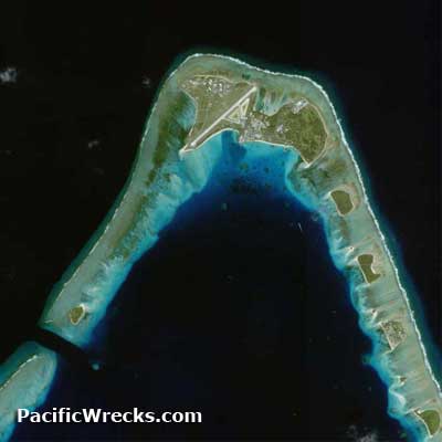
Lat 9° 23' 49N Long 167° 28' 15E Roi Airfield is located on the western portion of Roi-Namur Island, spanning the length of the island. Also known as Dyess Army Air Field (Dyess AAF) or Freeflight International Airport.
Construction
Built by the Japanese around three intersecting runways: Runway A (running roughly north-east to south-west), Runway B (running roughly north-west to south-east) and Runway C (running roughly east to west). An apron and limited taxiways were located at the base parallel to the runways. Two hangers were constructed on the eastern side of the runways. Defended by light and heavy anti-aircraft gun batteries around the entire airfield.
American Missions Against Roi
December 21, 1943–February 1, 1944
Battlefield
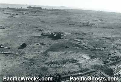
Occupied by the Americans after eight hours of fighting on February 2, 1944. All the war related wreckage was bulldozed onto the reef, including the remains of damaged Japanese aircraft captured on the airfield.
American Usage
The airfield was quickly repaired for American use, only the Runway A (4,400' x 260' as of December 1944) and Runway C (3,550' x 200' as of December 1944) were repaired.
Naming Honor
In 1944, Roi Airfield was renamed Dyess Field in honor of Lt. Col Aquilla J. Dyess who was killed in action on February 2, 1944 on northern Namur Island, and postumously earned the Congressional Medal of Honor for his actions.
American based at Roi-Namur
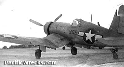
VMF-311 (F4U) 1944
Today
Roi Airfield has been used by the U.S. military since World War II. Today, it is off limits to visitors as it is used by the U.S. Army as
a radar station and tracking center.
Today, known as Dyess Army Air Field (Dyess AAF) also known as "Freeflight International Airport". The present day runway in use is in roughly the same location as the Japanese built Runway A. The single runway is oriented 22/04 and measures 4,499' x 150' surfaced by asphalt. Airport codes: ROI and ICAO: PKRO.
Contribute
Information
Do you have photos or additional information to add?
Last Updated
December 20, 2022
|