Pacific Wrecks
Pacific Wrecks    
  Missing In Action (MIA) Prisoners Of War (POW) Unexploded Ordnance (UXO)  
Chronology Locations Aircraft Ships Submit Info How You Can Help Donate

PacificWrecks.com
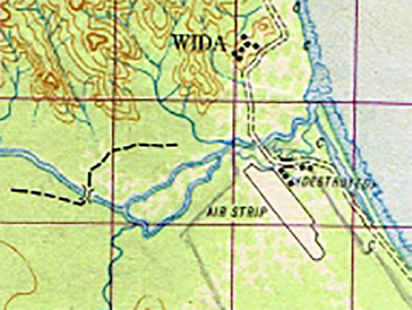
Map of Kieta Airfield (destroyed) south of the Aropa River on eastern Bougainville
Kieta Airfield is located south of Kieta and the Aropa River with the runway oriented northwest to southeast parallel the eastern coast of Bougainville.
Credit: Australian Army Survey Map  Date: 1945
Map  

High Resolution Version
Acquire This Image
|
 

Contribute Information
Do you have photos or additional information?

Previous Page

  Discussion Forum Daily Updates Reviews Museums Interviews & Oral Histories  
 
Pacific Wrecks Inc. All rights reserved.
Donate Now Facebook Twitter YouTube Instagram