|
Location
Lat 6° 15' 0S Long 155° 5' 60E Piva is located inland
from Torokina near the western coast of Bougainville Island bordering the Piva River. Two villages were located in this area: Piva No. 1 (to the south, closest to the coast) and Piva No. 2 (further inland). The Piva Trail ran alongside the Piva River, connecting to the East-West Trail and Numa Numa Trail.
Wartime History
On November 1, 1943 after U.S. Marines landed at Torokina and Japanese resistance was centered around Piva. On November 8, US Marine Raiders counterattacked against the Japanese at Piva. Afterwards, Japanese attempts to flank the 3rd Raider Battalion positions near Piva No. 1 failed and the Raiders counterattacked on November 9 causing the Japanese to withdraw further inland. With the area secured, the construction of two airfields was begun.
Piva
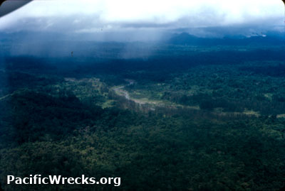
North Airfield (Piva Bomber, Piva Yoke, Piva 1)
American built airfield used by USN, USMC, RAAF and RNZAF, used as a bomber strip.
Piva
South Airfield (Piva Fighter, Piva Uncle, Piva 2)
American built airfield located to the south of Piva North, used as a fighter strip.
Japanese Counter Attack
Starting around March 6, 1944 the Japanese began actively probing and patroling the edge of the American perimeter. On March 8, 1944 during the morning, Japanese Army artillery
emplaced near Hill
250, Hill 600
and
other
locations
began
bombarding the
beachhead
at Torokina and Piva Airfield instead
of
the
forward areas
of the American perimeter. This bombardment proceeded a three-pronged assault. Return
fire from American destroyers, and the 37th Division, 6th field artillery
and 129th Infantry cannon
company. Immediately, 56 SBDs, 36 TBF attacked targets around Hill 1111.
Japanese artillery destroyed several planes at the Piva Airfields, fuel tanks and a 155mm Howitzer. One
man was killed and a dozen wounded. More shelling that evening wounded
ten others. Meanwhile, Japanese Army, 6th Division commanded by Lt. General Hyakutake prepared for a multi-pronged counterattack against the perimeter.
Iwasha Unit Attack: March 9-13, 1944
During the night of March 8-9, 1944 the "Iwasha Unit" attacked
Hill 700, but were initially beaten off. But by daylight
they had taken the hill and cut the McClelland Road, forcing
supplies to
be carried
to the forward area
by hand. The next day, the 1/145 and 2/145 counter attacked,
by afternoon restoring their line.
Muda Unit Attacks: March 10-15, 1944
Attacked the American sector, near Hill 260.
Lead by Col. Muda's 3d Battalion 13th Infantry. They succeeded in
occupying
Hill 260, overwhelming the outnumbered Americans, who counterattacked
on the 12th, but failed to retake the hill. Once the area was captured by the Japanese, a total of 10,000 rounds
of 105mm artillery shells were fired at Hill 260. The Japanese withdrew on March 17th and joined the "Magata Force". Two days later, Hill 260 was retaken and the original line restored.
Magata Unit Attack: March 10-17, 1944
The 45th Regiment attacked from the logging trail on March
12, and overran the forward American line. After failing,
a five day lull to transfer additional troops, they attacked
again on the 23rd, but was soon repulsed by infantry and tank
counter attacks. In total, approximately 3,000 Japanese were
killed, and 3,000+ wounded. The US Army 14th Corps suffered
263 dead.
Contribute
Information
Do you have photos or additional information to add?
Last Updated
April 16, 2023
|