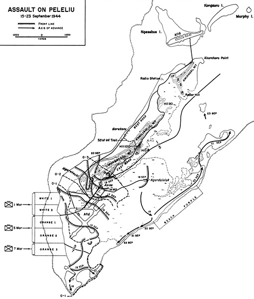
Map of Assault on Peleliu 15-23 September 1944
Map depicts the landing beaches including White 1, White 2, Orange 1, Orange 2, Orange 3 and Beach Purple (Purple Beach). Also, the line of advance by the U.S. Marine Corps (USMC) 1st Marine Division from the initial landing on September 15, 1944 until September 23, 1944 on Peleliu Island. Also indicated is Peleliu Airfield, Un-named Island (Island X), Hill 100 (Pope's Ridge). To the north is Ngesebus Island and Kongauru Island.
Credit: USMC Date: September 15–23, 1944
Map
High Resolution Version
Acquire This Image |
Contribute
Information
Do you have photos or additional information?
Make A Donation | Previous Page | Pacific Wrecks |