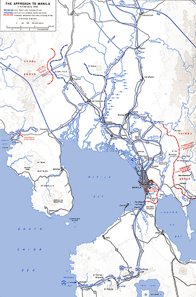
Map "The Approach To Manila 1-4 February 1945"
The blue hash line indicates U.S. front line, evening, January 31, 1945.
The arrow indicates axis of U.S. advance, dates indicated.
The red bars forward Japanese positions, evening, February 4, 1945.
The solid blue lines indicate U.S. Army divisional boundries lines.
The map includes Luzon areas including the Bataan Peninsula, Manila, Cavite, Clark Field, Angeles, Mt. Arayat, San Fernando, Calumpit, Malolos.
Also indicate are South China Sea, Subic Bay, Manila Bay and Laguna De Bay.
Credit: U.S. Army Map V Date: February 1, 1945– February 4, 1945
Map
High Resolution Version
Acquire This Image |
Contribute
Information
Do you have photos or additional information?
Make A Donation | Previous Page | Pacific Wrecks |