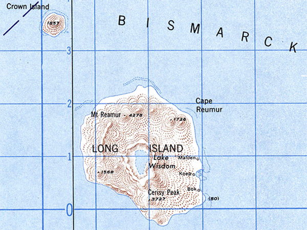
Map of Long Island (Arop, Ahrup, Pono) and Crown Island in the Vitiaz Strait
At the center is Long Island and at the center is Lake Wisdom with features Cape Reumur, Mt. Reaumur (Mount Reaumur) and Cerisy Peak. Beyond the Bismarck Sea to the north and Vitiaz Strait to the south.
Credit: U.S. Army Long Island 1:500,000 SB 55-2 Date: 1943
Map
High Resolution Version
Acquire This Image |
Contribute
Information
Do you have photos or additional information?
Make A Donation | Previous Page | Pacific Wrecks |