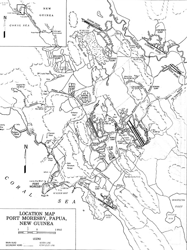
Location map of Port Moresby on the southern coast of New Guinea
(Main map) Indicated is Port Moresby (Town, Base D), Paga Point, Walter Bay bordering Ela Beach, Coral Sea, Joyce Bay, Kila Drome (3 Mile Drome, Kila Kila), Bootless Bay, Oyster Bay, Pyramid Point Road, Pyramid Point, (Native Village (Hanuabada), Fuel Jetty, Port Road, Bardia Road, Moresby Road (Beach Road), Pari Road, Kila Dump, Tatana Island with causeway and Liberty Ship Wharf, Barune Road, Barune Dump, Rouna Road, Wards Dump, Burns Peak, June Valley, Wards Drome (5 Mile Drome), 4 Mile Dump, Norris Dump, Jackson Dump, Jackson Drome (7 Mile Drome), Bypass Road, Bomana Dump, John's Gully Road, Tubusereia (eastward off map), Wallaby Dump, Waigani Dump, Waigani Swamp (Gavagabada), Durand Drome (17 Mile Drome), Waigani Road, Laloki River, Schwimmer Drome (14 Mile Drome), Schwimmer Dump, Berry Drome (12 Mile Drome).
(Inset map at upper left) South coast of New Guinea with Port Moresby, Tubusereia, Rigo Road, Kapa Kapa, Rigo, Kapa Kapa Trail, Karekodobu (Kalamazoo).
Credit: U.S. Army Date: 1943
Map
High Resolution Version
Acquire This Image |
Contribute
Information
Do you have photos or additional information?
Make A Donation | Previous Page | Pacific Wrecks |