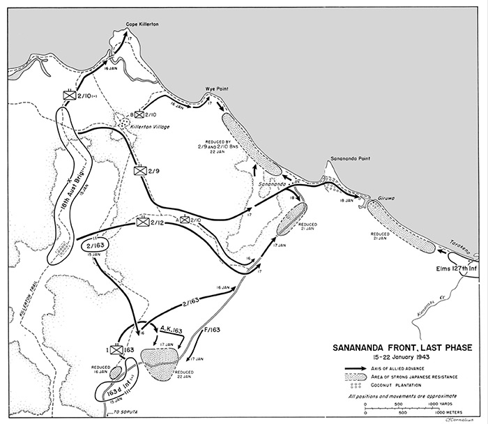
Map of the Sanananda Front, Last Phase
Includes Huggins Road Block, Sanananda Trail (Soputa-Sanananda Road), Sanananda (Sanananda Point), Giruwa (Girewo), Tarakeno, Konombi Creek, Wye Point, Cape Killerton on the north coast of New Guinea. The black lines indicate axis of Allied advances, with dates. The shaded areas are "area of strong Japanese resistance". The circles indicate coconut palm tree plantation areas.
Credit: U.S. Army Date: January 15-22, 1943
Map
High Resolution Version
Acquire This Image |
Contribute
Information
Do you have photos or additional information?
Make A Donation | Previous Page | Pacific Wrecks |