Location
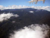
The Kokoda Trail is a prewar walking track over the Owen Stanley Range in New Guinea that spanned from Kokoda on the eastern side to Ower's Corner to the northeast of Port
Moresby. The track spans from Kokoda in Oro Province (Northern Province) southward over the Owen Stanley Range across steep ridges and deep valleys
to Ower's Corner in Central Province to the north of Port Moresby. During the Pacific War, known as the "Kokoda Track"
in Australian wartime references and known as the "Kokoda Trail" in American references and became the name most popularly used to this day.
Wartime History
After the July 21-22, 1942 landing on the north coast of New Guinea by the Japanese Army 144th Infantry Regiment commanded
by General
Horii advanced inland to Kokoda then advanced over the Kokoda Trail. Defending were Australian
soldiers that succeeded in delaying and hauling the Japanese advance over the Kokoda Trail. Suffering from casualties and lacking of supplies, the Japanese began to fall back
towards Kokoda then back to the north coast.
Today
The Kokoda Trail is walked by those interested in history
and challenging treks. Most trekkers are Australian, but
the track has become a popular trek for visitors of all nationalities and also Papua New Guinea people. The route takes several days to walk at a reasonable pace. Occasional landowner
disputes occur over the trail, but a 'trek permit' spread fees between
all villages.
Kokoda Trail (Kokoda Track)
Central Province Locations
McDonald's Corner starting point of the Kokoda Trail.
Owers' Corner the jeep track ends here and the walking trail begins.
Uberi first staging camp on the Kokoda Trail.
Imita Ridge site of the Golden Stairs.
Ioribaiwa furthest point of the Japanese Army advance September 16, 1942.
Menari village at the junction of two creeks.
Nauro village on the Kokoda Trail.
Efogi fourth staging point located on the southern slope.
Brigade Hill located on the Kokoda Trail.
Kagi located on the Kokoda Trail with postwar Kagi Airfield.
Myola (Lake Myola) landing area and drop zone during the Kokoda campaign.
Oro Province Locations
Templeton's Crossing No. 1 (No. 1 Dump) steepest and highest section of the Kokoda Trail.
Templeton’s Crossing No. 2 (No. 2 Dump) steepest and highest section of the Kokoda Trail.
Eora Creek (Iora Creek) located on the Kokoda Trail.
Etoa (aka "Lost Battlefield" "Japanese Forest Fort") located above Eora Creeek west of the Kokoda Trail.
Alolo (Alola) located to the northeast of Isurava.
Isurava located on the Kokoda Trail includes Isurava War Memorial.
Deniki located on the Kokoda Trail to the south of Kokoda.
Hoi located on the Kokoda Trail outside of Kokoda.
Kovelo (Pitoki) located at the start of the Kokoda Trail.
Kokoda (Kokoda Station) located at the northern end of the Kokoda Trail includes Kokoda Airifeld.
References
The Kokoda Track - An Historical Account Sequence of Events
Hell's Battlefield (2012) by Phil Bradley pages 44 (map), 48 (map profile)
Contribute
Information
Do you have photos or additional information to add?
Last Updated
October 28, 2021
|