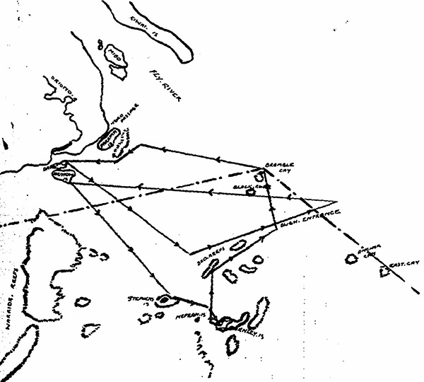
Map of search for survivors of MV Mamutu in the Gulf of Papua
Chart showing course followed during search for survivors of MV Mamutu 8 Aug 42 to 11 Aug 42. Vessel used MV Oliver Tomkins running time 36 hours distance covered 250 miles approximate.
Scale 1" to 12 miles. The map indicates the Gulf of Papua including the mouth of the Fly River, Daru Island and offshore islands.
Credit: ANGAU Diary "Search for Survivors from MV Mamutu" pages 97 - 98 Date: August 8–11, 1942
Map
High Resolution Version
Acquire This Image |
Contribute
Information
Do you have photos or additional information?
Make A Donation | Previous Page | Pacific Wrecks |