|
|
|
| Missing In Action (MIA) | Prisoners Of War (POW) | Unexploded Ordnance (UXO) |
| Chronology | Locations | Aircraft | Ships | Submit Info | How You Can Help | Donate |
|
 US Army April 11, 1944 |
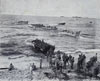
Location Lat 1° 40' 0S Long 150° 0' 0E Emirau Island is located in the Saint Matthias Island Group (St. Matthias Islands). Emirau is eight miles across from east to west. Wartime American spelling Emirau. Also spelled Emira. Pronounced "E-mir-a". When first sighted by Dampier in 1699 named "Squally Island" or "Storm Island". Nearby is Mussau Island. Today part of the Murat Rural LLG of New Ireland Province in Papua New Guinea (PNG). Prewar A German plantation planted with coconut palms harvesting copra and a Seven Day Adventist mission station were established on the southern portion of Emirau Island. Wartime History In early December 1940, Kregsmarine (German Navy) raiders Orion and Komet disembarked roughly 500 men, women and children on Emirau after the sinking their ships RMS Rangitane and Holmwood. The survivors lived on the island until rescued by Australian authorities. On March 12, 1944, the U.S. Joint Chiefs of Staff decided to capture Hollandia and Emirau as part of the campaign to neutralize Rabaul. On March 20, 1944 the U.S. Marine Corps (USMC) 4th Marines, 1st and 2nd Battalions, with the 3rd Battalion in reserve made an amphibious landing on Emirau. Offshore, USS Anthony DD-515 covered the landing. The Marines are were met by Seven Day Adventist missionaries who informed them there were no Japanese on the island. On March 21, 1944 construction began of Emirau Airfield and supporting infrastructure. On April 11, 1944 the Marines were relieved by the U.S. Army 147th Infantry Regiment. During April 8-21, 1944 USS Wintle DE-25 patrolled off Emirau then returned to patrol again during June 12-25, 1944 and again on August 28, 1944. Emirau Airfield Built by U.S. Navy (USN) Seabees, pair of parallel runways. Emirau Cemetery During 1944 the U.S. Army established Emirau Cemetery to bury American dead. At the end of the Pacific War, the graves were disinterred and transported to Manila and the United States for permanent burial. Homestead Lagoon Located on the west of Emirau. On March 25, 1944 PT Boats from Squadron 11 arrived supported by PT Boat tender USS Mobjack (AGP-7) and commenced patrols the next night. Hamburg Bay Located on the northwest coast, 9-10 fathoms deep. In late March 1944, the U.S. Navy built a base on Hamburg Bay. Kamikawa Maru Sunk off Emirau by the USS Scamp (SS-227) on May 29, 1943 Contribute
Information Last Updated
|
| Discussion Forum | Daily Updates | Reviews | Museums | Interviews & Oral Histories |
|