|
|
|
| Missing In Action (MIA) | Prisoners Of War (POW) | Unexploded Ordnance (UXO) |
| Chronology | Locations | Aircraft | Ships | Submit Info | How You Can Help | Donate |
|
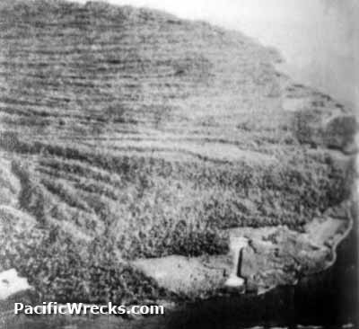  USN c1943 |
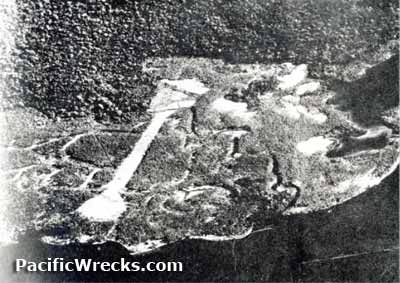
Location Lat 8° 0' 0S Long 157° 4' 60E Vila and Vila Point are located at the southeastern corner of Kolombangara Island. Borders Blackett Strait to the south, Disappointment Cove (Vila Harbor, Hamberi Cove) to the east and Kula Gulf to the southeast. Prewar and during the Pacific War part of the British Solomon Islands Protectorate (BSIP). Today, located in Western Province in the Solomon Islands. Prewar Prewar, the Vila area was part of two coconut palm plantations: Vila Plantation and Stanmore Plantation owned by Lever Brothers. Both were planted with coconut palms and harvested copra for export. Wartime History During 1943, occupied by the Japanese who built Vila Airfield and a base area at this location. Abandoned by the Japanese by early October 1943. On October 6, 1943 elements of of the 27th Infantry Regiment, 25th Infantry Division "Tropic Lighting" landed on Kolombangara and established perimeter defense around Vila Airfield. On October 11, 1943 the Americans were relieved by the 1st Battalion, Fiji Infantry. During early 1944, an engineering detachment established vegetable gardens at Vila Airfield for the remainder of the Solomons campaign. Vila Airfield Japanese airfield neutralized from the air, later occupied by Allied forces. F4F Wildcat Bureau Number 11983 Pilot Feliton crashed January 31, 1943 Contribute
Information Last Updated
|
Map May 10, 1943 |
| Discussion Forum | Daily Updates | Reviews | Museums | Interviews & Oral Histories |
|