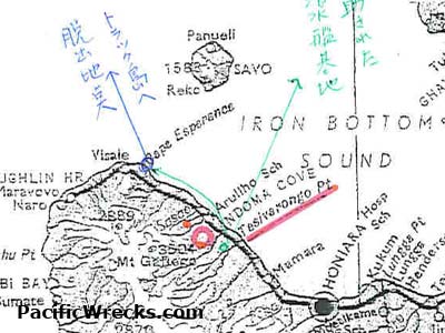
Map of Guadalcanal with annotations related to October 17, 1942
The large red ring is the area where A6M2 Zero pilot Harada and B5N Kate pilot Kuno crashed on October 17, 1942 about 500 meters apart. The smaller red circle is a special ningengyourai kichi (engineers), where Harada reached after walking from the crash site with Sato. Cape Esperance is where wounded and sick soldiers were evacuated during early February 1943. Credit: Kaname Harada Date: October 17, 1942 annotated 2005
Map