 |
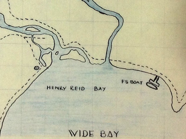
Enlargement map of Wide Bay and Henry Reid Bay bordering the southern coast of New Britain
The map indicates "FS Boat" a U.S. Army Freight and Supply Type (FS) vessel moored to a T shaped dock. The dotted lines indicate walking trails. The rivers indicated include the Powell River and Mavelo River (Henry Reid River).
Credit: NARA AGRS Operation One, Mission 3 "Investigate crashed P-38" Date: June 25, 1946
Map
High Resolution Version
Acquire This Image |
Contribute Information
Do you have photos or additional information?
Previous Page
|
|