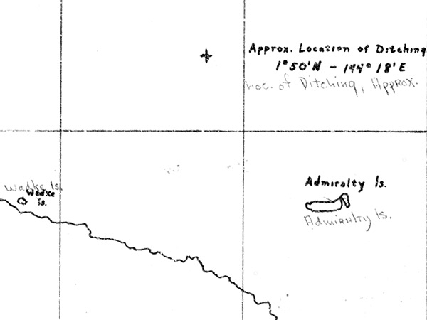
Map depicting the loss location of B-24D "Lakanooki" 42-40857 on a bombing mission against Yap Indicated is "+ approx. location of ditching 1° 50' N - 144° 18'E loc. of ditching, approx." to the northwest of the Admiralty Islands including Manus and Los Negros. Also indicated is Wewak on the north coast of New Guinea. Credit: MACR 7180 page 6 Date: July 15, 1944
Map