 |
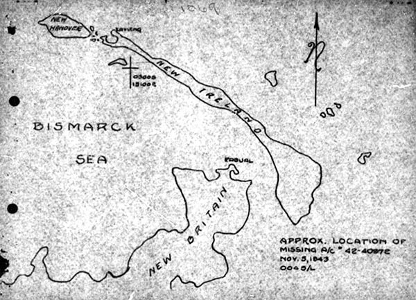
Map with † 0.3005 15100E indicating the location of B-24D Liberator 42-40972 bombing attack claiming three
direct hits on a CL [Light Cruiser] or CA [Heavy Cruiser] with the target destroyed at Lat 0.3005 Long 15100E
The map indicates New Britain, Rabaul, New Ireland Kavieng, New Hanover and Bismarck Sea.
The annotation at lower right reads: "Approx. location of missing a/c 42-40972 Nov. 5, 1943 0045/L" in fact, these coordinates were the location the bombing run at 12:40am when they claimed three direct hits on a Japanese warship. Afterwards, B-24D Liberator 42-40972 flew to the southwest and crashed over 350 miles away on New Guinea.
Credit: MACR 1069 page 3 Date: November 5, 1943
Map
High Resolution Version
Acquire This Image |
Contribute Information
Do you have photos or additional information?
Previous Page
|
|