 |
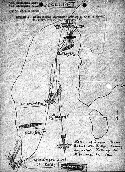
Map depicting the loss of B-25D "Sleepy Time Gal" 41-30190 crashed west of Simpson Harbor
The black line represents the coastline around Rabaul, Simpson Harbor and Matupi Island. The annotations include "Appendix A - Sketch showing approximate location of crash of aircraft 41-30190, B-25D-1 on 2 November 1943." The sketches also shows 248 and 190 in formation over Rabaul and bombing destroyers the flying south "190 left engine on fire" north of Beehives near a cruiser then 190 turns to the west and "approximate point of crash" and "Sketch of Simpson Harbor Rabaual, New Britain, showing approximate path of A/C. #190 when last seen."
Credit: MACR 1218 page 17 Date: November 2, 1943
B&W
High Resolution Version
Acquire This Image |
Contribute Information
Do you have photos or additional information?
Previous Page
|
|