Pacific Wrecks
Pacific Wrecks    
  Missing In Action (MIA) Prisoners Of War (POW) Unexploded Ordnance (UXO)  
Chronology Locations Aircraft Ships Submit Info How You Can Help Donate

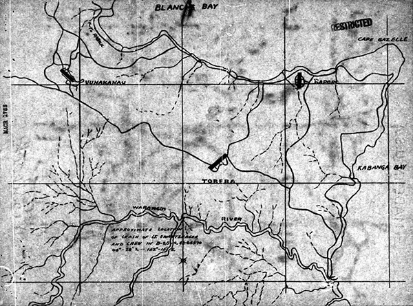
Map depicting the loss of B-25C 42-64570 crashed south of the Warangoi River
At the lower center is an X with "approximate location of crash of Lt. and crew in B-25C 04° - 298' S 152° 16' E.". Also indicated is Blanche Bay, Cape Gazelle, Kabanga Bay, Warangoi River, Vunakanau Airfield, Tobera Airfield and Rapopo Airfield on eastern New Britain.
Credit: MACR 1788 page 9  Date: January 20, 1944
Map  

High Resolution Version
Acquire This Image
|
   

Contribute Information
Do you have photos or additional information?

Previous Page

  Discussion Forum Daily Updates Reviews Museums Interviews & Oral Histories  
 
Pacific Wrecks Inc. All rights reserved.
Donate Now Facebook Twitter YouTube Instagram