 |
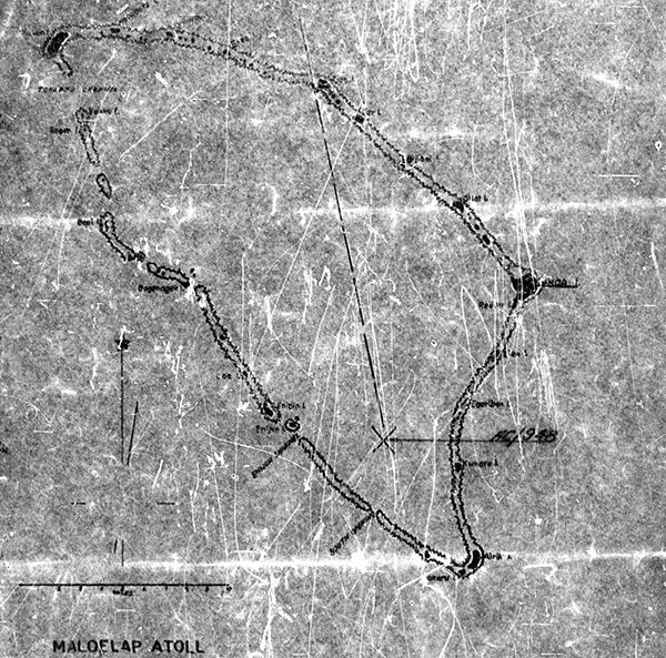
Map of Maloelap Atoll
Including Taroa Island, Elen Island, Egeriben Island, Kumaru Island, Airik Island, Makaru Island, Enijun Ilsand, Loa Island, Bogenagaki Island, Bebi Island, Bokku Island, Kaben Island (Kaven) and Jaraburu Island, Onimak Island, Enea Island, Tian Island, Tar Island, Gijibai Island, Ollot Ilsand and Pigeeatto Island. At the lower center, the "X" indicates the crash site of B-25G Mitchell 42-64948 in the southern portion of the atoll.
Credit: MACR 1845, page 2 Date: January 22, 1944
Map
High Resolution Version
Acquire This Image |
Contribute Information
Do you have photos or additional information?
Previous Page
|
|