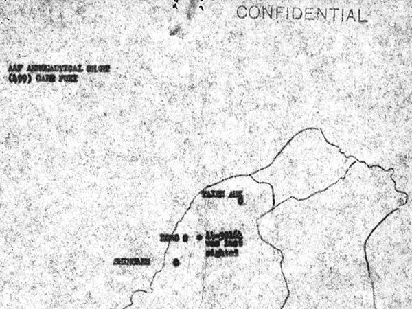
Map depicting the loss of B-25J Mitchell 44-30164 over northwestern Formosa
At the center is a (*) with the annotation "41-30164 was last sighted" indicating the position of B-25J Mitchell 44-30164 to the south of Taipei. The map is AAF Aeronautical Chart (449) marked "Confidential". Credit: MACR 14447 page 6 Date: May 17, 1945
Map