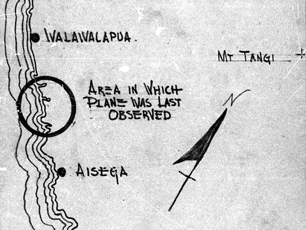
Enlargement of map of loss location of P-38G "Beautiful Lass" 43-2204 piloted by 2nd Lt. Ormond E. Powell The circle indicates "area in which plane was last observed" between Grass Point and Ivalaivalapua to the north and Aisega and Annen Point the south on the coast of West New Britain. Mount Tangi (Mt. Tangi) is located to the east. Credit: MACR 1502 page 7 Date: December 28, 1943
Map Enlargement