|
|
|
|
| Missing In Action (MIA) | Prisoners Of War (POW) | Unexploded Ordnance (UXO) |
| Chronology | Locations | Aircraft | Ships | Submit Info | How You Can Help | Donate |
|
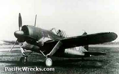
 NEIAF c1942 |
Location Lat 31° 40' 4S Long 116° 0' 54E Pearce Airfield is located at an elevation of 149' above sea level to the west of Pearce in Western Australia in Australia. Still in use today as RAAF Base Pearce. Construction Built as a military airfield. Wartime History Used by the Royal Australian Air Force (RAAF) and Netherlanders East Indies Air Force (NEIAF). RAAF units based at Pearce Airfield No. 77 Squadron (P-40E) established March 16, 1942–August 1942 Batchelor Field No. 14 Squadron No. 25 Squadron No. 5 Initial Training School CA-17 Mark 20 Mustang A68-13 Crashed June 2, 1950 vertically near the airfield Today Still in use today as a military airfield by the the RAAF as RAAF Base Pearce with three runways. The first runway is oriented 23/05 measures 5,548' x 148' surfaced with asphalt. The second runway is oriented 36L/18R measures 5,712' x 98' surfaced with asphalt. The third runway is oriented 36R/18L measures 8,002' x 148' surfaced with asphalt. Airport Code: ICAO: YPEA. References Royal Australian Air Force - RAAF Base Pearce official website Thanks to Daniel Leahy for additional information Contribute
Information Last Updated
|
Map Fallingrain |
| Discussion Forum | Daily Updates | Reviews | Museums | Interviews & Oral Histories |
|