 |
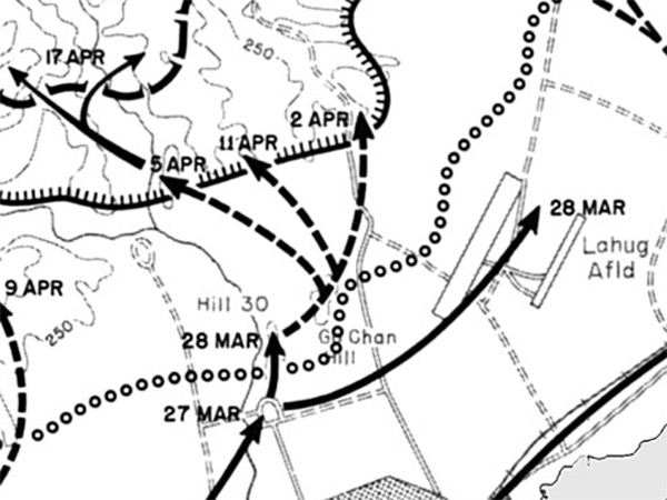
Map of Lahug Airfield north of Cebu City on Cebu Island
The map indicates Lahug Airfield, Hill 30, Go Chan Hill to the north of Cebu City. The solid black line indicates the U.S. axis of advance 26-28 March 1945 by the U.S. Army Americal Division. The dotted black line indicates the U.S. axis of advance 29 March to 11 April. The dotted line indicates Japanese outpost line of resistance. The solid line with hatches indicates the Japanese Main Line of Resistance (MLR). The dotted line with lower hatches indicates the Japanese last stand defensive line.
Credit: U.S. Army Date: March 26, 1945 to April 18, 1945
Map Englargement
High Resolution Version
Acquire This Image |
Contribute Information
Do you have photos or additional information?
Previous Page
|
|