Missing In Action (MIA)
Prisoners Of War (POW)
Unexploded Ordnance (UXO)
Chronology
Locations
Aircraft
Ships
Submit Info
How You Can Help
Donate
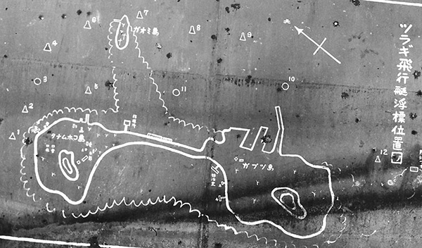
Captured map of
Tulagi Seaplane Base (Gavutu / Tanambogo)
The map includes (left)
Tanambogo Island
(top)
Palm Island (Gaomi)
and (right)
Gavutu
surrounded by a fringing coral reef in
Gavutu Harbor
. The triangle and circles with numbers indicate moorings for seaplanes and flying boats.
Credit: USMC via NARA 127-GW-1023-51744 Date: August 1942
B&W
High Resolution Version
Acquire This Image
|
JPEG 1599 x 1023 @ 600 dpi
Contribute Information
Do you have photos or additional information?
Previous Page
Discussion Forum
Daily Updates
Reviews
Museums
Interviews & Oral Histories
Pacific Wrecks Inc.
All rights reserved.