Pacific Wrecks
Pacific Wrecks    
  Missing In Action (MIA) Prisoners Of War (POW) Unexploded Ordnance (UXO)  
Chronology Locations Aircraft Ships Submit Info How You Can Help Donate

PacificWrecks.com
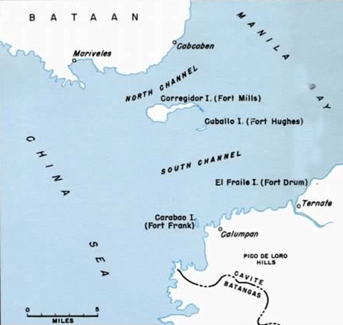
Map of the entrance to Manila Bay between Bataan Peninsula and Cavite Province
The map includes Manila Bay including the North Channel and South Channel including Corregidor Island, Caballo Island, El Fraile Island (Fort Drum) and Carabao Island (Fort Frank).
Credit: U.S. Army  Date: 1941
Map  

High Resolution Version
Acquire This Image
|
 

Contribute Information
Do you have photos or additional information?

Previous Page

  Discussion Forum Daily Updates Reviews Museums Interviews & Oral Histories  
 
Pacific Wrecks Inc. All rights reserved.
Donate Now Facebook Twitter YouTube Instagram