|
|
|
|
| Missing In Action (MIA) | Prisoners Of War (POW) | Unexploded Ordnance (UXO) |
| Chronology | Locations | Aircraft | Ships | Submit Info | How You Can Help | Donate |
|
 USN April 22, 1944 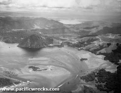 USAAF c1944 |
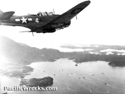
Location Tanahmerah Bay is located on the north coast of western New Guinea. Borders Tanahmerah village and Cape Tanahmerah. To the east are the Cyclops Mountains and beyond Hollandia (Jayapura) and Humboldt Bay. To the south is Depapre Bay and Depapre. Also known as Tanah Merah Bay or Teluk Tanahmerah meaning red soil bay in Indonesian. Prewar, a walking track connected Tanahmerah Bay inland to Hollandia. Prewar and during the Pacific War, located in Dutch New Guinea (DNG) in the Netherlands East Indies (NEI). Between 1963-2002 part of Irian Jaya. Today located in Jayapura Regency in Papua Province in Indonesia. Wartime History On April 22, 1944 in the morning "Operation Reckless" began with a U.S. Navy (USN) shore bombardment that proceeded the amphibious landing of the U.S. Army, 24th Division, 19th Infantry Regiment and 21st Infantry Regiment on the beaches of Tanahmerah Bay code named "Red Beach 1" at Depapre and "Red Beach 2" further to the north. Aferwards, the prewar track was expanded by the U.S. Army into a road inland to Hollandia. Today Several tanks hulks are to the east of Depapre at the base of the track. Ki-43 Oscar Crashed into Tanahmerah Bay, shot down by a P-38 piloted by Richard I. Bong and salvaged afterwards References U.S. Army in World War II - The Approach to the Philippines Chapter III The Hollandia Operations pages 53-59 Contribute
Information Last Updated
|
Map July 1945 Photo Archive |
| Discussion Forum | Daily Updates | Reviews | Museums | Interviews & Oral Histories |
|