 |
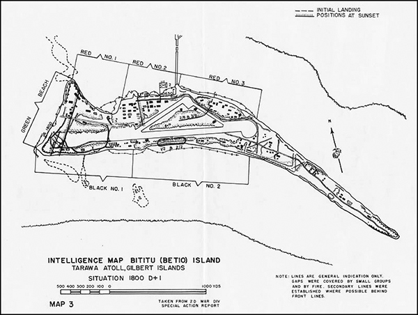
Map of Intelligence Map of Bititu (Betio) Island Tarawa Atoll, Gilbert Islands Situation 1800 D+1
The map shows Tarawa Island (Betio) with the invasion beaches: Red No. 1, Red No. 2, Red No. 3 on the north coast of the island. Green Beach on the west coast and Black No. 1 and Black No. 2 on the south coast. The solid line with hash marks indicates the positions at sunset on D+1 (November 21, 1943) at 18:00 (6:00pm).
Credit: USMC Date: November 21, 1943
Map
High Resolution Version
Acquire This Image |
Contribute Information
Do you have photos or additional information?
Previous Page
|
|