 |
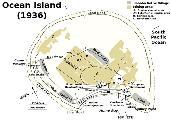
Map of Ocean Island (Banaba) surrounded by a fringing coral reef in the South Pacific
The map includes native villages: Buakonikai, Uma,
Tabiang, Tabwewa. Also indicated is the European settlement, roadway, w/t (wireless transmitter - radio tower), cableway, government headquarters, Chinese quarters, Native labor quarters, cantilever structures, boat harbor, Lilian Point and Sydney Point bordering Home Bay. Ocean Island is fringed by a coral reef with a canoe passage at the west. The yellow areas indicate mining areas including (A) original central area, (A*) Extension of central area. (B) Eastern area and (C) Northern area.
Credit: Prewar Date: 1936
Map
High Resolution Version
Acquire This Image |
Contribute Information
Do you have photos or additional information?
Previous Page
|
|