 |
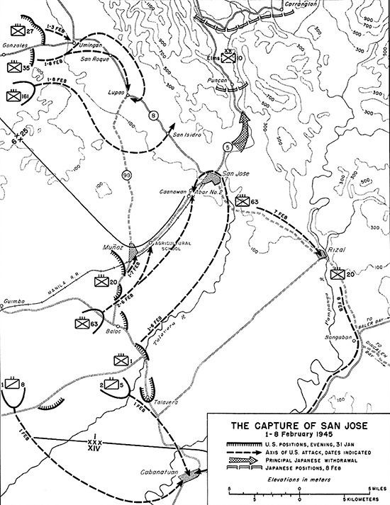
Map of The Capture of San Jose 1-8 February 1945
The map indicates locations on central Luzon including San Jose. Munoz (Muñoz), San Isidro, Lupao, San Roque, Umingan, Rizal, Cabanatuan. The black dotted lines show the axis of U.S. attacks, dates indicated. The gray arrow is the principal Japanese withdrawal route northward. The hatches show Japanese positions as of February 8, 1945. The solid line indicates the boundary between the 6th Division and 25th Division and the Corps boundary between I Corps and XIV Corps north of Cabanatuan.
Credit: U.S. Army Date: February 1, 1945–February 8, 1945
Map
High Resolution Version
Acquire This Image |
Contribute Information
Do you have photos or additional information?
Previous Page
|
|