 |
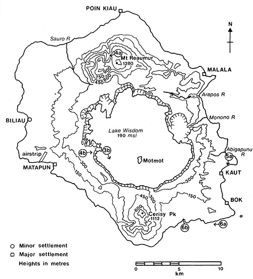
Map of Long Island (Arop, Ahrup, Pono) in the Vitiaz Strait
Long Island includes Lake Wisdom with Motmot (created by volcanic eruption in 1968 and expanded 1973-1974). At the left (northern) Mount Reaumur with an elevation of 4,199' / 1,280m and at the right (south) is Cerisy Peak with an elevation 3,648' / 1,112m. In the center is Lake Wisdom at 500' / 190m above sea level. On the coast are the five major and minor settlements: Matapun (Matafun), Bok, Kaut and Poin Kiau at Kiau Point and Biliau. The map also indicates the mouth of rivers including Abigapuna River, Monono River, Arapos River, Sauro River.
Credit: Long Island, Papua New Guinea: Introduction page 409 Date: 1982
B&W
High Resolution Version
Acquire This Image |
Contribute Information
Do you have photos or additional information?
Previous Page
|
|