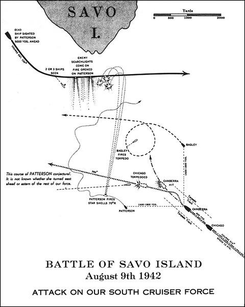
Map of the Battle of Savo Island August 9th 1942 attack on our south cruiser force The map indicates the southern half of Savo Island. The solid line at upper left indicates the Japanese force 0143 ships sighted by Pattersonn 5000 yards ahead, course estimated 125°, 2 or 3 ships seen, enemy search lights com on fire opened on Patterson. This course of Patterson conjectural. It is not known whether she turned east ahead or astern of the rest of our forces.
Southern Force: USS Chicago (CA-29), HMAS Canberra (D33), USS Patterson (DD-392) and USS Bagley (DD-386) with torpedo tracks to each side of the column. Credit: USN Date: August 9, 1942
Map