 |
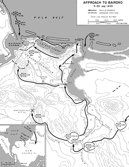
Map Approach To Bairoko 5-20 July 1943
The map indicates the north coast of New Georgia bordering Kula Gulf including Bairoko Harbor, Bairoko, Dragons Peninsula, Leland Lagoon, Enogai (Enogai Point), Enogai Inlet, Boekineru, Triri, Maranusa, Enogai River, Giza Giza River, Tamakau River. The double dotted lines are walking trails including the Munda-Bairoko Trail. The solid black lines indicates the American axis of advance and dates. The dotted line indicates Japanese positions. At the lower left is an insert map showing the location of Arundel Island, New Georgia and Vila on Kolombangara Island bordering Kula Gulf.
Credit: U.S. Army Map 8 Date: July 2, 1943–July 15, 1943
Map
High Resolution Version
Acquire This Image |
Contribute Information
Do you have photos or additional information?
Previous Page
|
|