 |
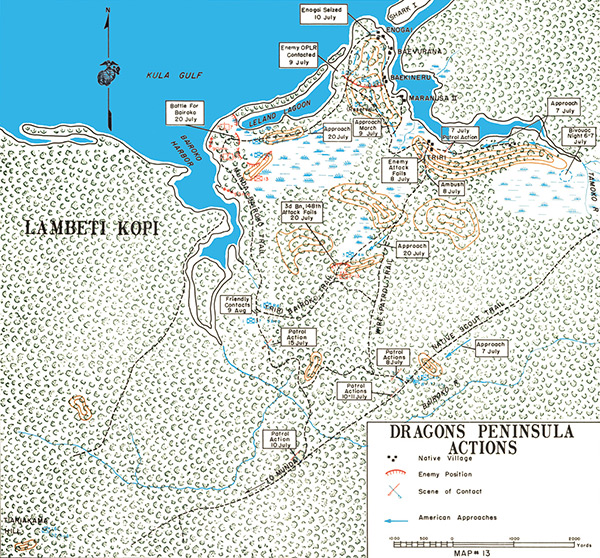
Map of Dragons Peninsula Actions
The map indicates the north coast of New Georgia including Enogai Inlet, Enogai (Enogai Point), Baevurana, Baekineru, Maranusa II and Triri, Tamoko River, Leland Lagoon, Bairoko Harbor (Bauroko Harbor) and Kula Gulf. Dotted lines indicate walking trails including the Munda-Bairoko Trail, Triri-Bairoko Trail, Wire Patrol Trail, Native Scout Trail and Enogai-Bairoko Trail. The three dots indicate native villages. The red line with hatches enemy positions (Japanese). The rectangles indicate the advance by U.S. Marine Corps 1st Mar Raider Regiment (reinforced).
Credit: USMC Map No. 13 Date: July 1943
Map
High Resolution Version
Acquire This Image |
Contribute Information
Do you have photos or additional information?
Previous Page
|
|