|
|
|
|
| Missing In Action (MIA) | Prisoners Of War (POW) | Unexploded Ordnance (UXO) |
| Chronology | Locations | Aircraft | Ships | Submit Info | How You Can Help | Donate |
|
 Laurent 2003 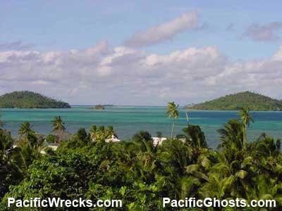 Laurent 2003 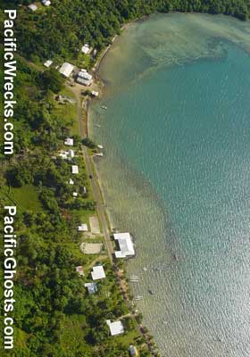 Laurent May 4, 2003 |
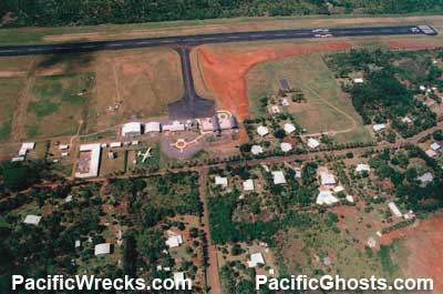
Location Wallis Island is the largest island in the Territory of the Wallis and Futuna Islands. Also known as "Uvea". Wallis Island is seven miles long and for miles wide in the eastern part of the islands. Prewar On August 16, 1767 discovered by HMS Dolphin and named "Wallis Island" after Samuel Wallis, the ship's navigator. During 1837, French Catholic missionaries arrived on the island. In 1887 became a French protectorate and was combined with Futuna as part of the French colony of New Caledonia. Wartime History After the fall of France in 1940, Wallis was controlled by pro-Vichy administrators. On May 26, 1942 a Free French corvette from New Caledonia that deposed the regime and three days later U.S. Marines arrived to defend the island. By agreement between the U.S. and Free French, Wallis Island was to be defended by American troops and code named "Lameduck". On March 27, 1942, U.S. Marines 8th Defense Battalion (reinforced) under Colonel Raphael Griffin arrived from Tutuila to guard the island along with U.S. Navy Construction Battalion "Seabees" Company A & B that began their first major construction work in the Pacific. CBMU 504 (Naval Construction Battalion Maintenance Unit) arrived during May 1942 and worked on the island until early 1944. Seabees build 70 miles of road on the island, storehouses, a 72 bed hospital and housing facilities. By January 1944, a 15 x 500 gallon tank farm was also established on the island. By February 19, 1944 dismantling of the base was began on Wallis and Samoa. Materials salvaged were transported back to Tutuila for use at more forward bases. Hihifo Airfield (Wallis Island Airport) Built by US Navy during October 1942. Still in use today as the island's only airport. Mata'Utu Located on the eastern coast, near the center of the island, overlooking Mata Utu Harbor. Present day capital of Wallis. Gahi Harbor Gahi village is located on the southeast coast of Wallis Island. USN Seabees built a causeway measuring 75' long made of logs filled with rock and surfaced with coral and sand over the reef into deep water. Halalo Lat 13° 20' 60S Long 176° 10' 60W Located near the south-west of the island. Hihifo Seaplane Base Built by the US Navy during October 1942 Fighter Strip Built by the US Navy late in 1942 Contribute
Information Last Updated
|
Map Fallingrain |
| Discussion Forum | Daily Updates | Reviews | Museums | Interviews & Oral Histories |
|