Missing In Action (MIA)
Prisoners Of War (POW)
Unexploded Ordnance (UXO)
Chronology
Locations
Aircraft
Ships
Submit Info
How You Can Help
Donate
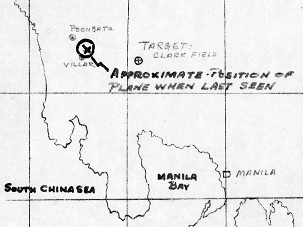
Map of
A-20G "Sleepy Time Gal" 43-21302
"approximate position of plane when last seen" near Villar on
Luzon
The map indicates Poonbata, Villar, Target: Clark Field and
Mania
. The line traces the cloastline of
Luzon
bordering
Manila Bay
and
South China Sea
.
Credit: MACR 11382 page 3 Date:
January 7, 1945
B&W
High Resolution Version
Acquire This Image
|
Contribute Information
Do you have photos or additional information?
Previous Page
Discussion Forum
Daily Updates
Reviews
Museums
Interviews & Oral Histories
Pacific Wrecks Inc.
All rights reserved.