Missing In Action (MIA)
Prisoners Of War (POW)
Unexploded Ordnance (UXO)
Chronology
Locations
Aircraft
Ships
Submit Info
How You Can Help
Donate
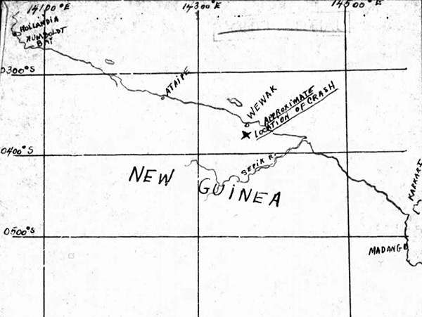
Map of "approximate location of crash" of
B-24D "Pete the Carrier" 41-24068
south of
Wewak
on
New Guinea
The map includes a black line representing the north coast of
New Guinea
from west
Hollandia
,
Humboldt Bay
,
Aitape
,
Wewak
,
Sepik River
,
Madang
and
Karkar Island
.
Credit: MACR 13578 page 4
Date:
August 29, 1943
Map
High Resolution Version
Acquire This Image
|
Contribute Information
Do you have photos or additional information?
Previous Page
Discussion Forum
Daily Updates
Reviews
Museums
Interviews & Oral Histories
Pacific Wrecks Inc.
All rights reserved.