Missing In Action (MIA)
Prisoners Of War (POW)
Unexploded Ordnance (UXO)
Chronology
Locations
Aircraft
Ships
Submit Info
How You Can Help
Donate
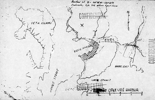
Map indicating the loss of
B-24J "Taloa" 44-40716
over
Kure
The map indicates "X position of 34° 16'N 132° 33' E indicates A/C 716 when last seen" indicating the loss of
B-24J "Taloa" 44-40716
. Also indicated is
Kure
,
Kure Harbor
,
Eta Island (Eta Jima)
, Hayase Strait, Seto Island, Ondo Strait and Hiro Bay, Hiro.
Credit: MACR 14990 page 6 Date:
July 28, 1945
Map
High Resolution Version
Acquire This Image
|
Contribute Information
Do you have photos or additional information?
Previous Page
Discussion Forum
Daily Updates
Reviews
Museums
Interviews & Oral Histories
Pacific Wrecks Inc.
All rights reserved.