Pacific Wrecks
Pacific Wrecks    
  Missing In Action (MIA) Prisoners Of War (POW) Unexploded Ordnance (UXO)  
Chronology Locations Aircraft Ships Submit Info How You Can Help Donate

PacificWrecks.com
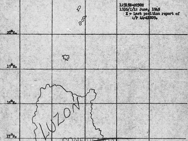
Map depicting the ditching location of B-24M "Out of the Night II" 44-41809
At the upper right is the annotation "12315E-2030N 1334/I/12 June, 1945 X - Last position report of A/P 44-41809".
The map indicates northern Luzon, Batanes Islands and southern Formosa. The map spans the South China Sea to the west and Philippine Sea to the east.
Credit: MACR 14879 page 4  Date: June 12, 1945
Map  

High Resolution Version
Acquire This Image
|
   

Contribute Information
Do you have photos or additional information?

Make A Donation | Previous Page | Pacific Wrecks

  Discussion Forum Daily Updates Reviews Museums Interviews & Oral Histories  
 
Pacific Wrecks Inc. All rights reserved.
Donate Now Facebook Twitter YouTube Instagram