 |
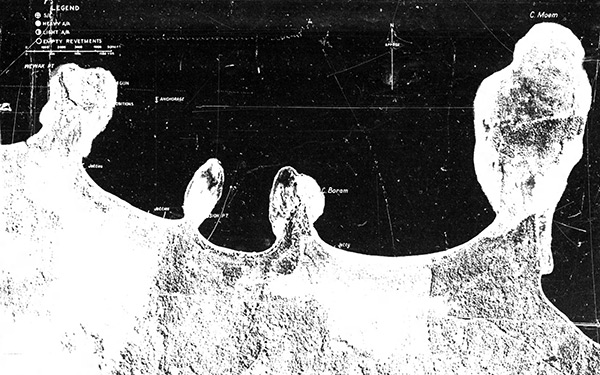
Vertical view from Wewak Point to Cape Moem on the north coast of New Guinea
At the left (west) is Wewak Point (Wewak Town), Wewak Airfield (Wirui, Wewak Central), Mission Point, Cape Boram (Boram), Boram Airfield and Cape Moem at right (east) on the north coast of New Guinea. From left (west) to right (east) borders Dallman Harbor (West Wewak Harbor), Wewak Harbor (Anchorage) with several jetties and Boram Bay with jetty and Dove Bay to the right (east). The legend in upper left includes S/L (search light), Heavy A/A (heavy anti-aircraft), Light A/A (light anti-aircraft) and empty revetments. The photo strip read: "C.I.U. T-31 Wewak & Boram, New Guinea. (Wewak A/D, Lat 03° 34'S, Long 143° 37 1/2' E., Boram A/D Lat 03° 35' S, Long 143° 40' E) 30 Aug 1943."
Credit: MACR 3981 page 3 Date: August 30, 1943
Digital
High Resolution Version
Acquire This Image |
Contribute Information
Do you have photos or additional information?
Previous Page
|
|