Missing In Action (MIA)
Prisoners Of War (POW)
Unexploded Ordnance (UXO)
Chronology
Locations
Aircraft
Ships
Submit Info
How You Can Help
Donate
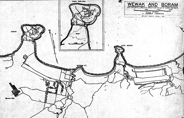
Map depicting crash site of
B-25G Mitchell 42-64889
off
Wewak
on the north coast of
New Guinea
The location of crash is indicated by the (*) due north of
Cape Boram
to the northeast of
Wewak
off the north coast of
New Guinea
. The map also indicated
Boram Airfield
and
Wewak Airfield (Wirui)
,
Mission Point
and
Wewak (Wewak Point)
with an elargement inset of
Wewak Town
.
Credit: MACR 1177 page 10 Date:
November 27, 1943
Map
High Resolution Version
Acquire This Image
|
Contribute Information
Do you have photos or additional information?
Previous Page
Discussion Forum
Daily Updates
Reviews
Museums
Interviews & Oral Histories
Pacific Wrecks Inc.
All rights reserved.