|
|
|
|
| Missing In Action (MIA) | Prisoners Of War (POW) | Unexploded Ordnance (UXO) |
| Chronology | Locations | Aircraft | Ships | Submit Info | How You Can Help | Donate |
|
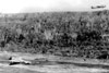 McMurchie May 31, 1943 |
Location Lat 5° 39' 42S 132° 43' 53E Langgoer Airfield is located at 10' above sea level at Langgoer (Langgur) on the northeast of Kai Island in the Kai Islands Group (Kai Islands). Also spelled Langgoer, Langgur or Langoer. Prewar and during the Pacific War located in the Netherlands East Indies (NEI). Today located in Maluku Province (Provinsi Maluku) of Indonesia. Still in use today as Dumatubin Airport. Wartime History During 1942 built by the Japanese. Starting in the middle of March 1943 bombed by the Allies until the middle of October 1944. Japanese units based at Langgoer Airfield 5th Sentai (Ki-45 Nicks) American missions against Langgoer (Langgur) March 17, 1943–October 16, 1944 Today Still in use as Dumatubin Airport as a small airport until closed on December 19, 2014. The single runway is oriented 27/09 measures 4,265' x 98' surfaced with concrete. Airport codes: ICAO: WAPL IATA: LUV. On December 19, 2014 closed and commercial flights moved to the new Karel Sadsuitubun Airport further to the south. Since the closure, the Indonesian Air Force continues to use Dumatubin Airport and the former airport area is restricted. Contribute
Information Last Updated
|
Map Fallingrain Map Mapcarta |
| Discussion Forum | Daily Updates | Reviews | Museums | Interviews & Oral Histories |
|