 |
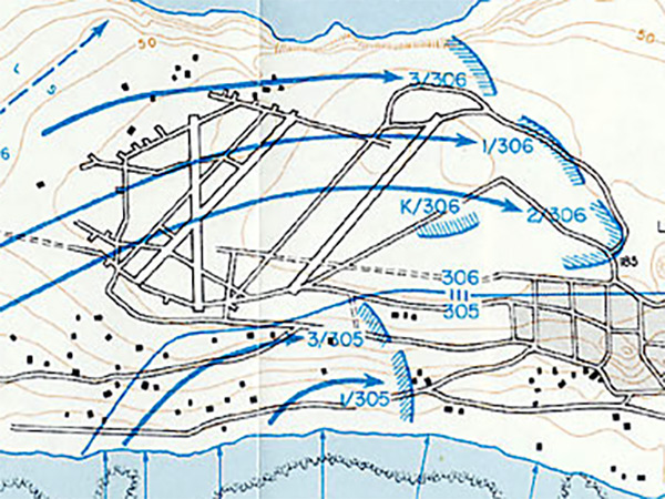
Map of Ie Shima Airfield at the center of Ie Shima
At the right is the western edge of Ie (Ie Town) and at the bottom is the southern edge of the island with landing beaches "Red 1" and "Red 2" and the area designated "Red 3" but not used in the landing. On April 16, 1945 the U.S. Army 77th Division made an amphibious landing on southern Ie Shima. Landing at "Green 1" on the southwest beaches was 306th Infantry Regiment 1st Battalion and 2nd Battalion and advanced inland and patrolling eastward to occupy Ie Shima Airfield. Meanwhile, landing at "Red 1" was the 305th Infantry Regiment (305th RCT), 3rd Battalion. Landing at "Red 2" was the 305th Infantry Regiment (305th RCT), 1st Battalion.
Credit: U.S. Army via U.S. Army in World War II Okinawa: The Last Battle Map No. 19 Date: April 16, 1945
Map Enlargement
High Resolution Version
Acquire This Image |
Contribute Information
Do you have photos or additional information?
Previous Page
|
|