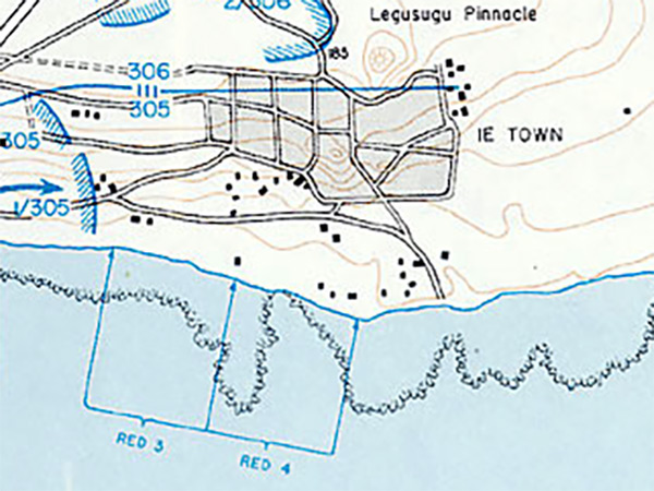
Map of Ie (Ie Town) and Iegusugu Pinnacle (The Pinnacle) inland from the southern coast of Ie Shima
At the center is Ie (Ie Town) and at the bottom is the southern edge of the island with landing beaches "Red 3" and "Red 4" that were not used in the landing. On April 16, 1945 the U.S. Army 77th Division made an amphibious landing on southern Ie Shima. Landing further to the west at "Red 1" was the 305th Infantry Regiment (305th RCT), 3rd Battalion. Landing at "Red 2" was the 305th Infantry Regiment (305th RCT), 1st Battalion. Afterwards, both advanced inland and eastward to assault Ie (Ie Town). Credit: U.S. Army via U.S. Army in World War II Okinawa: The Last Battle Map No. 19 Date: April 16, 1945
Map Enlargement