|
|
|
|
| Missing In Action (MIA) | Prisoners Of War (POW) | Unexploded Ordnance (UXO) |
| Chronology | Locations | Aircraft | Ships | Submit Info | How You Can Help | Donate |
|
 USN January 1944 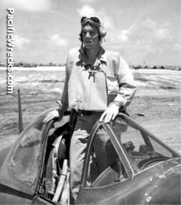 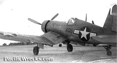 USMC May 1944 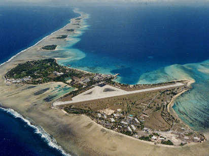 USN c1990s 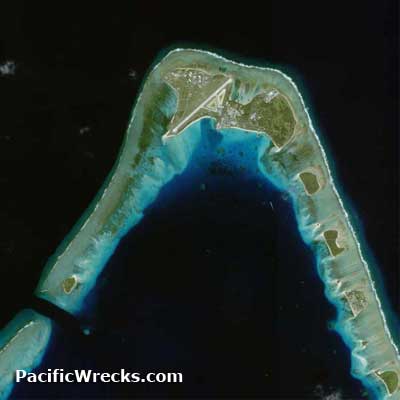 Google Earth 2002 |
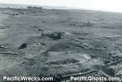
Location Lat 9° 23' 49N Long 167° 28' 15E Roi Airfield is located on the western portion of Roi Island in Kwajalein Atoll in the Marshall Islands. During late 1944 during the U.S. occupation, fill was added between Roi Island and Namur Island, forming Roi-Namur Island. Today known as Dyess Army Air Field (Dyess AAF) or Freeflight International Airport. Construction In 1914, Japan occupied the Marshall Islands and built Roi Airfield with three intersecting runways: Runway A (running roughly north-east to south-west), Runway B (running roughly north-west to south-east) and Runway C (running roughly east to west). An apron and limited taxiways were located at the base parallel to the runways. Two hangars were constructed on the eastern side of the runways. Defended by light and heavy anti-aircraft guns. Wartime History On December 8, 1941 at the start of the Pacific War, Japanese bombers from Roi Airfield bomb Wake Island. Starting in late 1943 targeted by American aircraft ahead of Operation Flintlock to capture Kwajalein Atoll. American missions against Roi December 21, 1943–February 1, 1944 Battlefield On February 1, 1944 occupied by the Americans after eight hours of fighting. All the war related wreckage was bulldozed onto the reef, including the remains of damaged Japanese planes captured on the airfield. American Usage The airfield was quickly repaired for American use, only the Runway A (4,400' x 260' as of December 1944) and Runway C (3,550' x 200' as of December 1944) were repaired. Naming Honor In 1944, Roi Airfield was renamed Dyess Field in honor of Lt. Col Aquilla J. Dyess who was killed in action on February 2, 1944 on northern Namur Island, and postumously earned the Congressional Medal of Honor for his actions. American based at Roi-Namur VMF-311 (F4U) 1944 Today Roi Airfield has been used by the U.S. military since World War II. Today, it is off limits to visitors as it is used by the U.S. Army as a radar station and tracking center. Today, known as Dyess Army Air Field (Dyess AAF) also known as "Freeflight International Airport". The present day runway in use is in roughly the same location as the Japanese built Runway A. The single runway is oriented 22/04 and measures 4,499' x 150' surfaced by asphalt. Airport codes: ROI and ICAO: PKRO. Contribute
Information Last Updated
|
December 22, 1943 Map Fallingrain View on Google Earth |
| Discussion Forum | Daily Updates | Reviews | Museums | Interviews & Oral Histories |
|