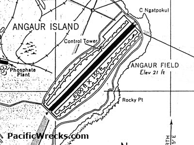
Approach Chart for Angaur Airfield on Angaur Island
Angaur Field has an elevation of 12' above sea level. The single runway meausres 6,200' x 150' borders Cape Ngatpokul to the northeast and Rocky Point to the south and to the west was a phosphate plant. Credit: USAAF Date: December 1944
Map Enlargement