|
|
|
|
| Missing In Action (MIA) | Prisoners Of War (POW) | Unexploded Ordnance (UXO) |
| Chronology | Locations | Aircraft | Ships | Submit Info | How You Can Help | Donate |
|
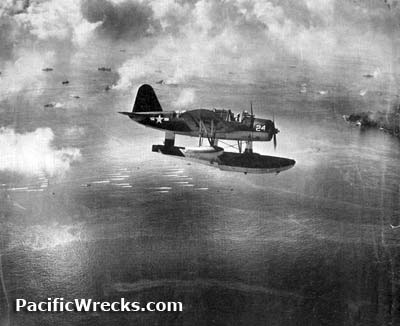 USN September 17, 1944 |
Location Angaur Island is located in Angaur State in the south of Palau (Republic of Palau, Belau, Pelew). Also misspelled "Anguar" in some wartime documents. In the local language known as "Ngeaur". The island has only one village with a population of roughly 200 people. Located roughly 500 moles to the west is Mindanao. Prewar The Germans began mining phosphate from the island in 1909, and the Japanese continued the operation until the war. The island's monkeys descend from a pair of brought over in the early 1900s to monitor air quality in the island's phosphate mines. Heavily defended by the Japanese, Angaur Island's lone village overlooks the harbor on the western coast. The harbor's, which is nearly enclosed, has water's so calm one would think it was a giant swimming pool. Instead of their tunnels, though, you're more likely to see the green ponds that have formed in the pits, now home to crocodiles. Wartime History During "Operation Stalemate II" Angaur and Peleliu were assaulted by a force comprising the 1st Marine Division (Reinforced) and the U.S. Army 81st Division "Wildcat". The 81st's 321st and 322nd Regimental Combat Teams were landed on Angaur on September 17, 1944. On September 20, 1944, in the morning Division Commander Maj. Gen. Paul J. Mueller announced that the island was secure. On October 21, 1944 Japanese opposition aside for stragglers is overcome. About 1,300 Japanese have been killed and 45 captured on Angaur to date. Total U.S. casualties through this date are 264 killed and 1,355 wounded or injured. That same day, Angaur Airfield is ready for bombers. Orin Whitman 1st Marine Division recalls: "1st Marine Division hit Peleliu 15th sept 1944, we were held in reserve one day, 17th we landed on Angaur and 22nd. The Marines called for help, [on Peleliu] on 23rd and [from Angaur] we relieved some of the marines they were shot up bad." Angaur Airfield Built by the Americans used as a base for USAAF and USMC. Japanese Lighthouse North of town, there's an old Japanese lighthouse hidden by a jungle on a hill. It takes a sharp eye to find it, but you'll enjoy a great view from the top if you take the trouble. Shinto Shrine There's a miniature wooden Shinto shrine located on the northwestern coast. Buddhist Memorial Markers honoring fallen Japanese soldiers. DMS 17 (DD-340) USS Perry Sunk September 14, 1944 by sea mine Contribute
Information Last Updated
|
Map 1944 |
| Discussion Forum | Daily Updates | Reviews | Museums | Interviews & Oral Histories |
|