Missing In Action (MIA)
Prisoners Of War (POW)
Unexploded Ordnance (UXO)
Chronology
Locations
Aircraft
Ships
Submit Info
How You Can Help
Donate
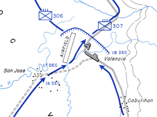
Map of
Valencia
and
Valencia Airfield
in central
Leyte
The blue line with arrow indicates the axis of U.S. Army advances. The line with hatching indicates forward positions as of December 18, 1944. Indicated is Highway 2, San Jose,
Valencia
,
Valencia Airfield
and Cabulihan.
Credit: U.S. Army Date:
December 15, 1944
–
December 21, 1944
Map
Enlargement
High Resolution Version
Acquire This Image
|
Contribute Information
Do you have photos or additional information?
Previous Page
Discussion Forum
Daily Updates
Reviews
Museums
Interviews & Oral Histories
Pacific Wrecks Inc.
All rights reserved.